Kasol Kheerganga Trek: Best Time, How to Reach and Trek Highlights

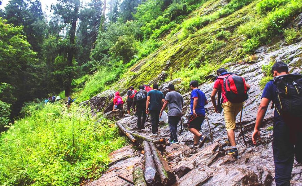
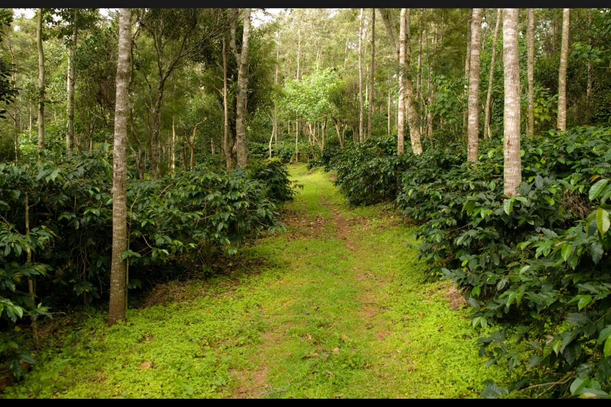
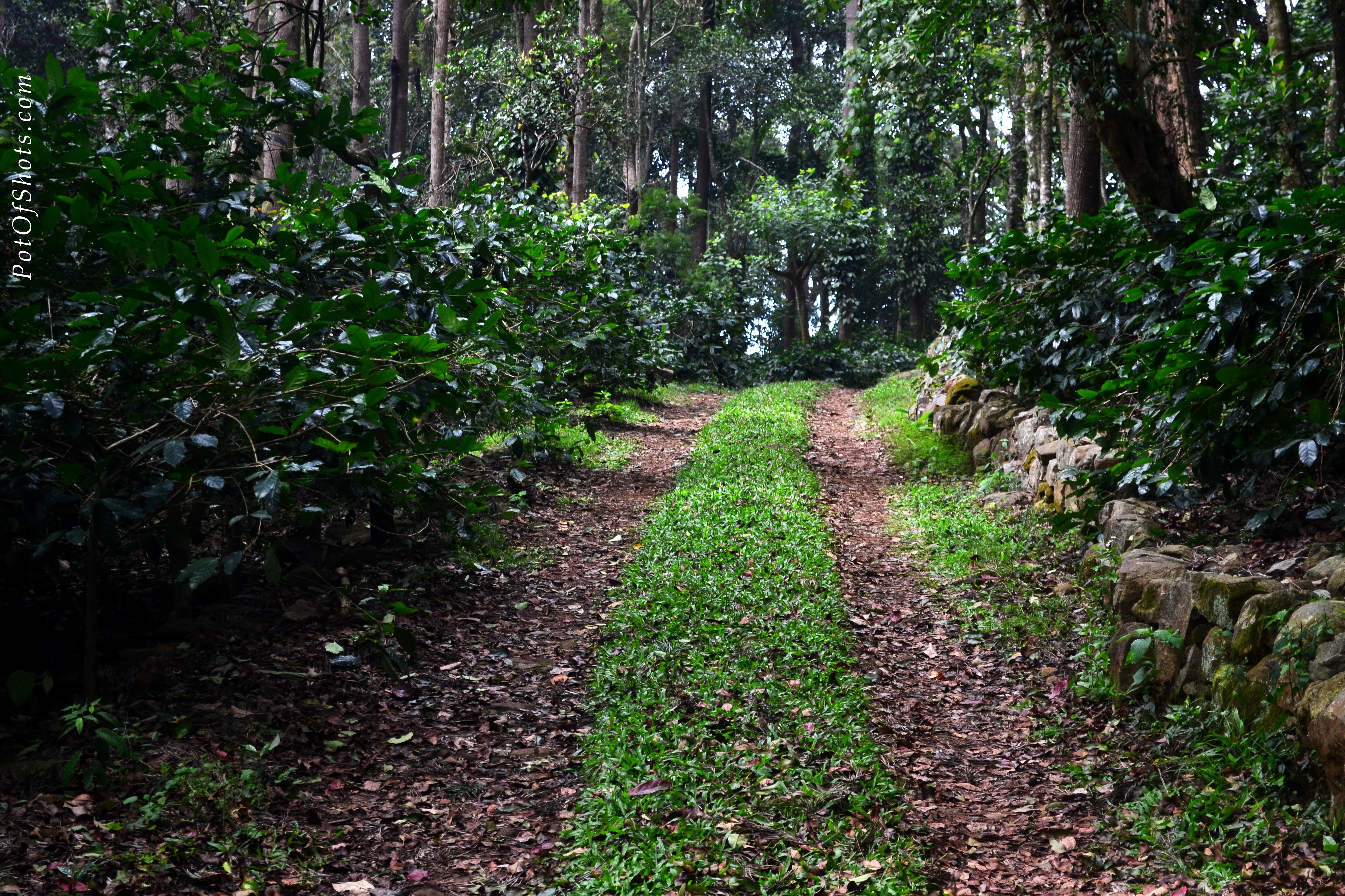
Himachal Pradesh is famous for its scenic beauty, and the trekking trails that take you through dense forests are one of them. This state has a hidden gem, Kheerganga, which is a paradise for nature and adventure junkies. The trails of Kasol Kheerganga Trek take you through natural hot water springs, picturesque villages, and dense forests. 

Situated in Parvati Valley, Kheerganga is one of the off-beat places in Himachal. With a distance of 12 to 13 kilometers, an easy to moderate trek is ideal for experienced and beginner trekkers. Here is a complete guide for the Kasol Kheerganga Trek, which includes details about the best time, where to stay, and the trek route. 

Best Time for Kasol Kheerganga Trek

Kasol Kheerganga Trek can be done any time of the year. However, the most suitable time for the Kheerganga Trek is from September to November and April to June. The temperature during these months is pleasant and offers an ideal trek experience. It is advised to avoid trekking during the monsoon months, between July and August, because this region receives heavy rainfall, making the trail slippery and increasing the chances of casualty. Road blockage and landslides are common during this time. If you are fond of snow and want to experience trekking in the snow, then you can do the Kasol Kheerganga Trek in December. 

How To Reach 

By Road: The most convenient way to reach Parvati Valley is by road. Kasol is around 531 kilometers away from Delhi, and you can get there by bus or car in 11 to 12 hours. This road trip from Delhi to Kasol will reward you with incredible views on the way. One can find many Volvo buses running from Delhi to Kasol. 

By Air: Flying from Delhi to the nearest airport to Kasol is one of the easiest and fastest ways to reach here. The closest airport to Kasol is Kullu Manali Airport in Bhuntar. This airport is around 31 km away from Kasol. However, Bhutnar has limited flight connectivity; the best alternative for this is Mohali Airport in Chandigarh, which is around 300 km away. From Chandigarh, you can take a taxi or bus to reach Kasol. 

By Train: Being a small and remote town in Himachal Pradesh, Kasol is not connected to other cities by railways. However, you can take a train to the nearest Jogindar Nagar Railway Station, which is around 4 km away. However, Joginder Nagar Railway Station is not connected to major Indian cities, so you can take a train to Pathankot Junction. Then, from Pathankot, you can take a train to Jogindar Nagar.

Upon arrival, one can hire a taxi to Kasol or take a local bus from the Jogindar bus stand. Alternatively, some tourists also choose to reach Chandigarh first by train and take a bus or taxi for the rest of the road trip to Kasol. 

Kheerganga Trek’s Highlights 

Kheerganga has several things that attract trekkers with its beauty. Here, we have mentioned a few highlights of the Kasol Kheerganga Trek. Do check it out. 

1. Natural Hot Water Springs

Situated amidst natural surroundings, the Kheerganga trek provides a chance to take a dip into the natural hot water springs in Parvati Kund. You can wash away all your tiredness from the trek and restore your body’s energy. Situated at 13000 feet in height, the Hot water spring is one of the Prime attractions of the Kasol Kheerganga Trek. 

2. Remote Villages

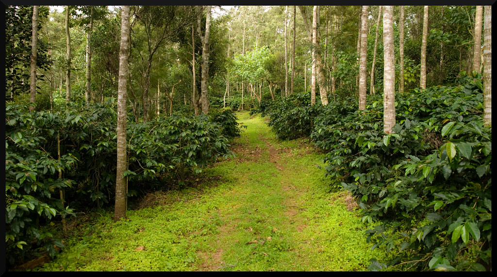
While trekking towards Kheerganga through the dense forests, you will also come across small remote villages like Pulga and Kalga. By visiting these villages you will get a chance to learn about the traditions and culture of people residing in these villages. 

3. Camping

Camping at Kheerganga under the sky full of stars in Parvati Valley is a great experience for all nature lovers. Sitting under the sky full of twinkling stars is truly a treat to your eyes. While camping here, you can stay awake the entire night and observe these glittering stars. 

4. Manikaran Sahib Gurudwara 

Manikaran Sahib Gurudwara is one of the popular pilgrimage sites for Sikhs and Hindus. You can visit the Gurudwara and explore Manikaran Town. You can seek blessings at the Gurudwara and visit hot water springs. 

5. Parvati Valley

Parvati Valley is one of the most scenic locations in Himachal Pradesh, and it is renowned for its stunning views. You spend some time here and admire the beauty of the valley. There are many places to visit near Parvati Valley, including the waterfalls, trekking trails, and hot water springs amidst the mountains covered in snow. 

Tips for Kasol Kheerganga Trek 

  • Trekkers must check the weather conditions before going for the trek and pack according to the weather conditions. 
  • There are no ATMs near Parvati Valley, so trekkers must carry enough cash. The last working ATM is available in Kullu or Bhutnar. 
  • Plan a trip for 4 to 5 days so that you can also explore the nearby attractions along with the Kasol Kheerganga Trek. 
  • Carry a first-aid kit to be used in case of emergency. 
  • Pack warm and comfortable winter clothes because the temperatures can drop anytime and nights can be chillingly cold. 
  • Do carry a camera to capture the best sights while trekking. 
  • Do not litter on the trail, and maintain cleanliness. 

FAQ’s 

Q1. What is the distance and duration of the Kasol Kheerganga Trek?

The total distance you will cover on Kasol Kheerganga Trek is around 12 to 13 kilometers, and it will take 6 to 7 hours to get to the top. The trek starts from Barshaini, so you must reach Barshaini from Kasol. 

Q2. What should I wear for the trek?

Trekkers must wear comfortable clothes and sturdy trekking shoes with a good grip, which must also be water-resistant. 

Q3. Is the Kasol Kheerganga Trek suitable for beginners?

Yes, the Kasol Kheerganga Trek can be easily done by beginners with good physical fitness. First-time trekkers must go for a guided trek. 

Conclusion

So, are you ready for the adventure? If so, pack your bags and embark on this magical journey to Kheerganga. Taking you through hot water springs, dense forests, and remote villages, the Kasol Kheerganga Trek provides a relaxed escape from your busy schedule.

Image

The Daily Post Photo Challenge: Wanderlust

A couple of weeks back, in mid of April, I was in Ooty, a hill station in the Nilgiri Mountains in southern India. On April 17, I went for a day trip to the neighboring town of Coonoor, known for its greenery and scenic beauty.

I enjoyed every bit of this road trip as we drove past beautiful bungalows, orchards, canopied roads and sprawling tea gardens along the slopes.

Coonoor, tea garden, nilgiri, hills

And it was during the Ooty trip, I realized the usefulness of smartphone cameras. They are very handy when it comes to clicking pictures from a moving bus or car. Thanks to my Lumia540. 🙂

I’ll be sharing my Ooty Diaries soon…

Published in response to The Daily Pose Photo Challenge: Wanderlust
Indian Bloggers

Image

The Daily Post Photo Challenge: Pure

buddha, dordenma, thimphu, bhutan

Follow my blog with Bloglovin

“We are shaped by our thoughts; we become what we think. When the mind is pure, joy follows like a shadow that never leaves.”
~ Buddha 

This week’s photo challenge theme, pure, transports me to that beautiful morning in Thimphu. The morning I had a glimpse of Buddha, pure and sublime, overlooking the hills and the city.

buddha, dordenma, thimphu, bhutan

Published in response to The Daily Post Photo Challenge: Pure

Rewind Time at Yercaud

coffee estate, yercaud, tamilnadu

Imagine a place in the hills, where the wind sometimes wafts, sometimes freewheels. The mercury is too cautious to cross the 30th degree mark, and the homes are the old world. Where a thousand greens tinge the same hill. The forests become lakes and lakes become forests in a wink. And a dozen peaks take your eye to the furthest horizons. More than 173 years ago, Sir Thomas Monroe, the governor of erstwhile Madras Presidency, found such a place. Not enough has changed in Yercaud. Like many of its sisters, it has avoided the ravaging beast of urbanity. The whirls of smoke don’t choke its forest air, and time is sedentary. Yercaud resorts take pride in showcasing the antiquity of the place, giving you much to marvel at.

Yercaud Forest walk, Tamilnadu – Image via Flickr by Joseph Jayanth

Shevaroys for the Quaint Nature Lover

Nestled in the Shevaroys Range in Eastern Ghats, Yercaud is some 5,000 feet above sea level, and, luckily for the reserved, sparsely populated. The jewel of South India, it heavily contrasts the bustle and chaos of regional metropolises. Like many hill stations, it still retains its colonial buildings and institutions like the prestigious Montfort School, Fairholme Bungalow and Grange summer resort. Central to its charm is the Yercaud Lake, a silvery body of water lined by hills, dense parks, and natural shoals. When you’re not boating, the lake-side parks, which include The Botanical Garden and The National Orchidarium, offer irenic strolls.

yercaud lake, botanical garden yercaud, tamilnadu

Botanical Garden, Yercaud, Tamilnadu – Image via Flickr by solarisgirl

The undulating landscape attracts trekkers from around the country to see the enchanting Kiliyur Falls empty into the valley below as it swells with the waters of Yercaud’s lakes. On the way to the highest point of Shevaroys Hills, where its famous temple stands, is the hill station’s oldest cottage, Norton’s Bungalow. Situated nearby, the Bear Cave is a short potholer’s journey of a few hundred metres.

High Points and Horticulture Delights

Yercaud hill station, yercaud, tamilnadu

Hill station in Yercaud, Tamilnadu – Image via Flickr by Joseph Jayanth

When the British developed this hill station, they introduced fruits to sustain its economy, a trade that still continues. Visitors to Yercaud can stroll through its citrus fruit groves, banana plantations and coffee estates, where the coffee bloom dots the forests with white flowers in fairy-tale effect. The plantations transport you to old-time India, where regional cultures blended seamlessly with borrowed British idiosyncrasies.

Coffee estate in Yercaud, Tamilnadu – Image via Flickr by V.v

During the time of the British, trekking to Yercaud Hills’ vantage points wasn’t uncommon for both men and women. The topography is home to old and new temples and fascinating places to visit in Yercaud that you may stumble into. East of the hills lies the popular Pagoda Point, where the sun drowns in into the vast, dense jungles of Yercaud edging towards the brightly-lit Salem city – a breathtaking sight for an evening picnic with friends and family, where you can indulge in archery after your picnic, depending on the Yercaud hotels you may be staying. Like Pagoda Point, these hills are home to many other vantage points: Tipperary Viewpoint, Karediyur viewpoint, Arthur’s Seat and Lady’s Seat, which aristocratic British women had been known to visit. A short distance from Lady’s Seat is Yercaud’s renowned Silk Farm and Rose Garden, both popular attractions that immerse you in the artistry of nature and man.

yercaud hill station, tamilnadu

Hill station in Yercaud, Tamilnadu – Image via Flickr by Joseph Jayanth

Because that is really what a holiday in Yercaud is all about: witnessing the endearing relationship between its few residents and its overwhelming nature. Whether you’re starting from Chennai, Hyderabad or Bangalore to Yercaud, your travel will be comfortable thanks to the fine roads.


This is a guest post by Nanditha, who is a travel writer by profession and works with HolidayIQ. She is a lover of world cultures, languages, and food, and guides travelers to make travel adventurous with her experience.
Indian Bloggers

Image

Sikkim Diaries: Visiting a Piece of Heaven Called Gurudongmar

lake, Gurudongmar, Lachen, North Sikkim

Gurudongmar was on my bucket-list since 2011 when I planned with my friends for North Sikkim travel for the first time. Unfortunately, due to a devastating earthquake in Sikkim in the same year, we had to cancel our trip. Nevertheless, visiting Lake Gurudongmar was my destiny. I finally made it after 5 long years. 🙂

Selfie, Lumia 540, Gurudongmar, lake, north sikkim

Nestled in the lap of the Himalayas, at approx. 17,800 feet above the sea level, the holy lake is about 3.5-hour drive from Lachen, a small village where tourist can halt for the night.

We started early, at 4 am. It was a terribly bumpy ride on the rough mountain roads till the army check post after Thangu, which was our only halt during this hectic journey.

mountain roads, north sikkim

north sikkim, mountain, desert, road

26641876673_f105988cca_h
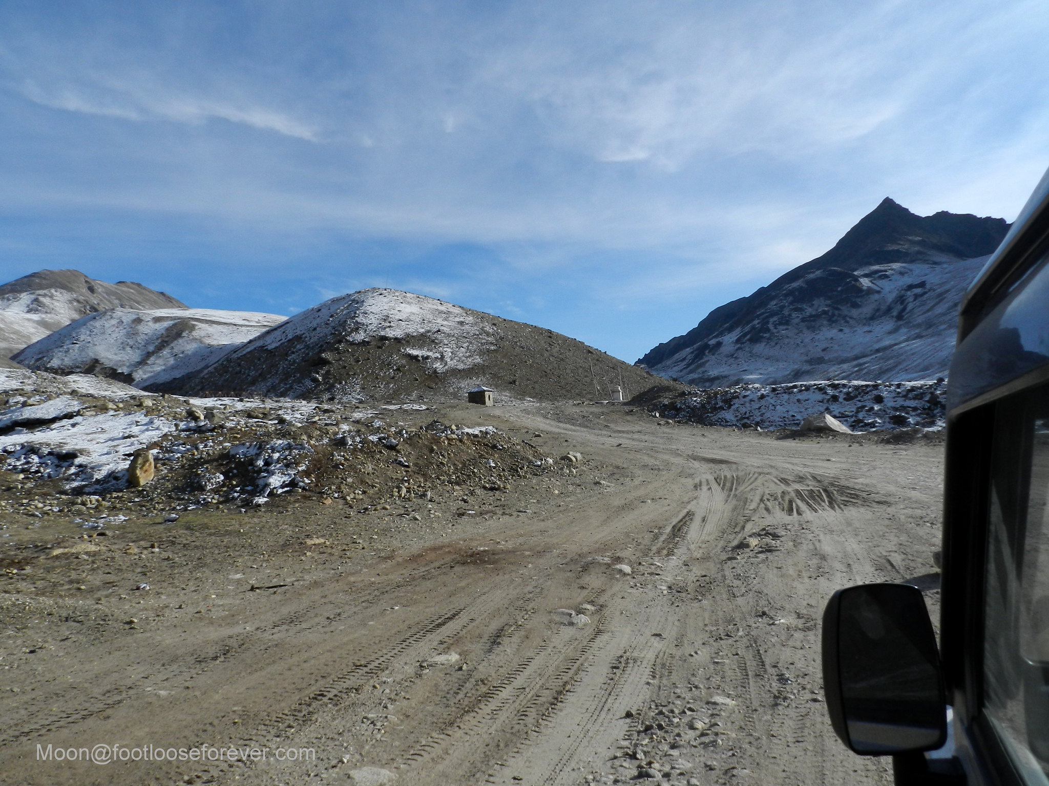
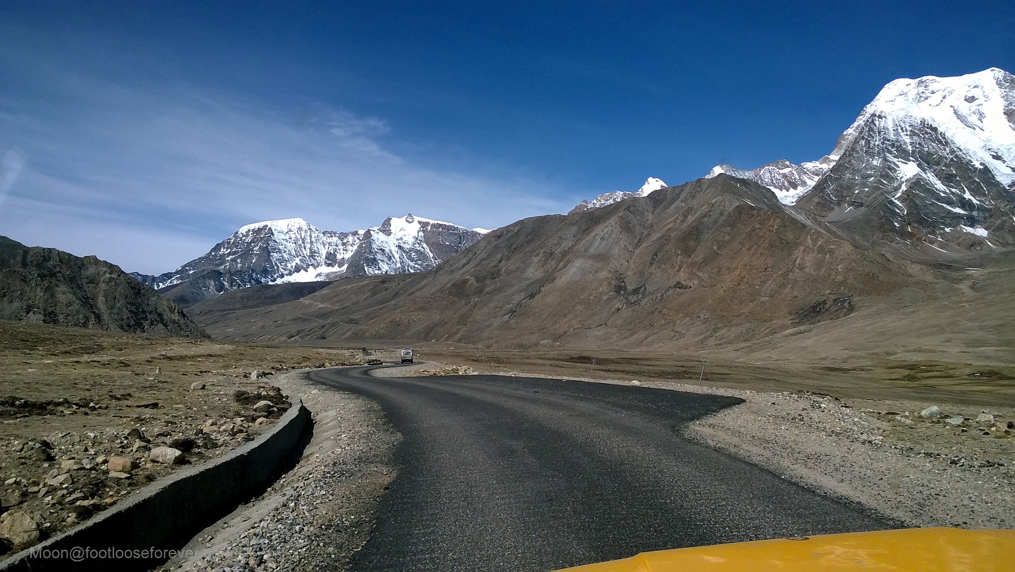
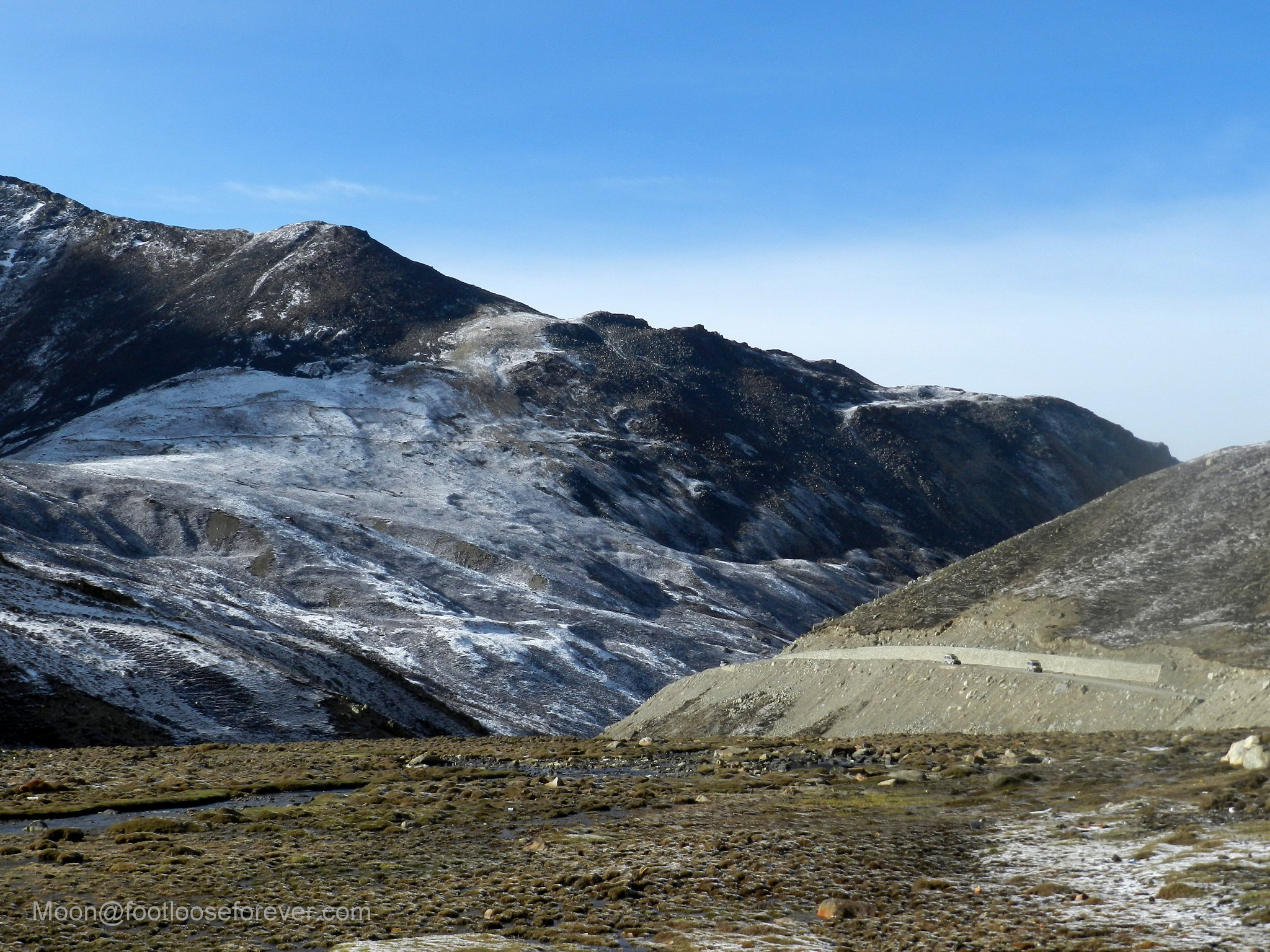
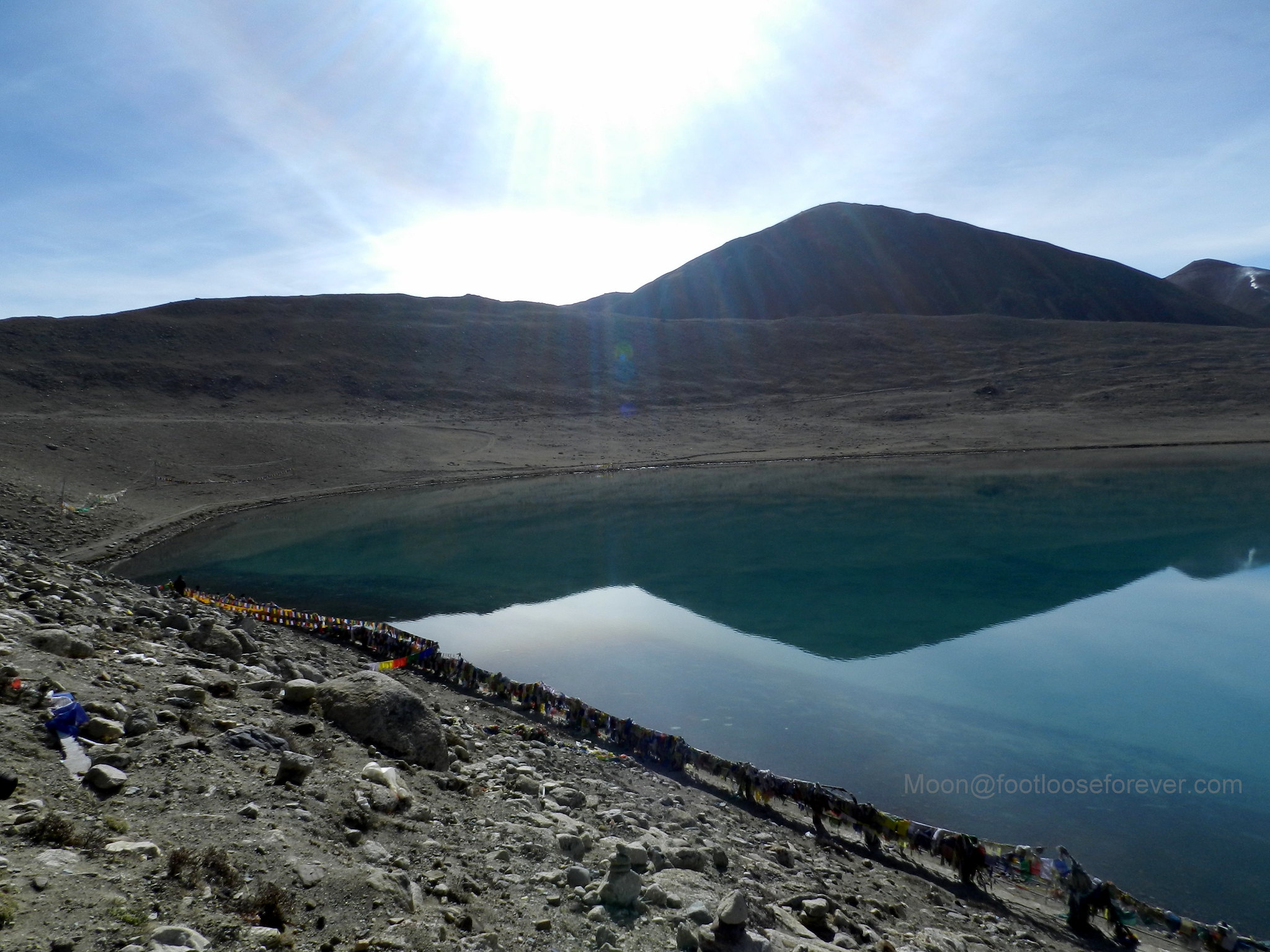
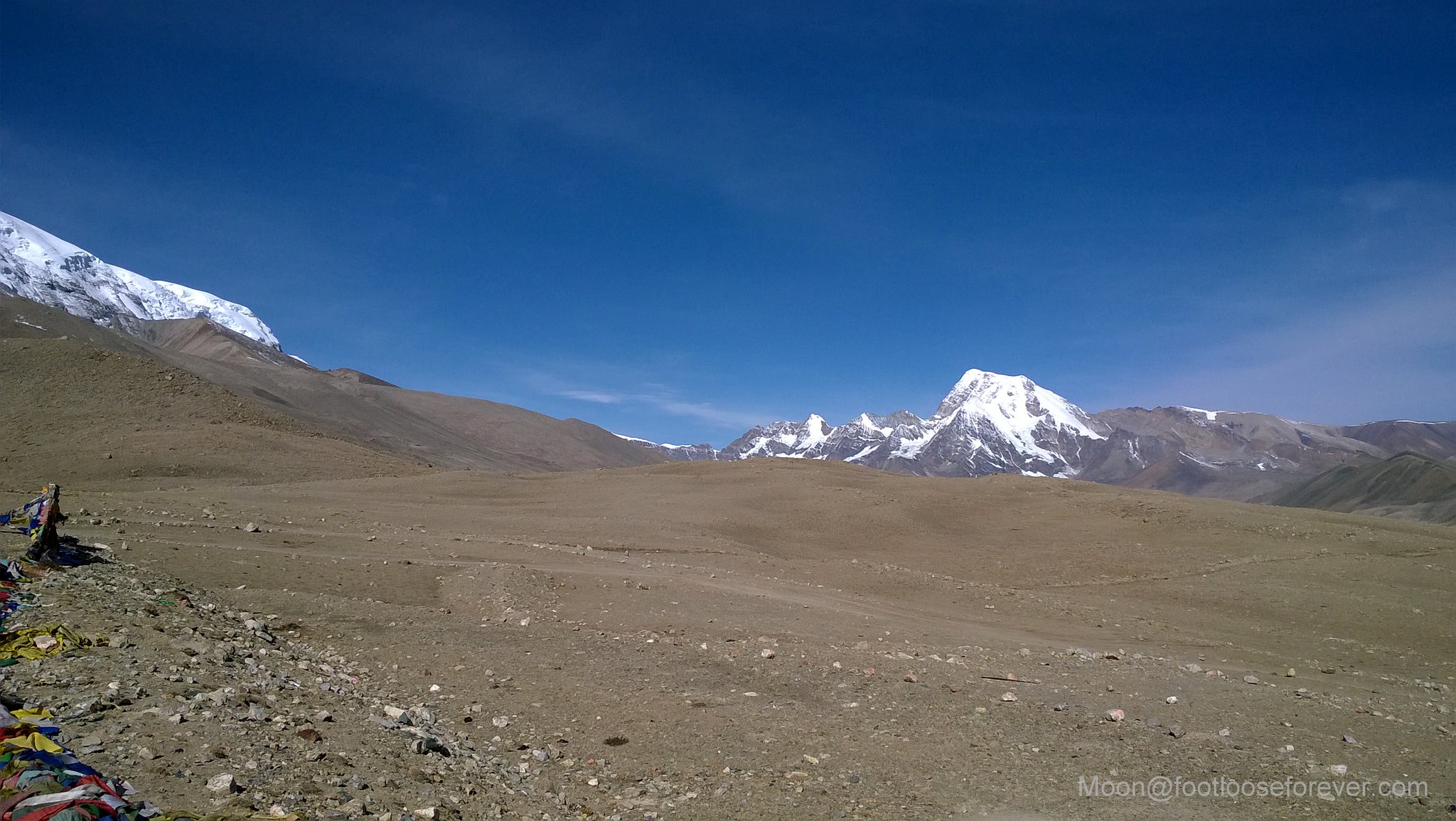
The road gets better from here, offering a smooth ride, which is a rarity in North Sikkim. 😛   😀  mountain, road, desert, north sikkim

North sikkim, lachen, gurudongmar, landscape, mountains

As we were nearing the lake the landscapes changed drastically without any trace of trees and plants. It looked more like a desert with dune-like formations visible at the horizon. Exalted and overwhelmed, one of our group members commented that the landscapes reminded him of Ladakh. 🙂

road, gurudongmar, north sikkim

mountain, desert, north sikkim, gurudongmar

Whatever it might look like, the mountain desert looked outlandish and fascinating to me. I was spellbound with the sights of such exotic landscapes.

way to gurudongmar, north sikkim, himalayas

mountains, himalayas, north sikkim

snow, mountains, north sikkim

We saw herds of yaks grazing on the fields, totally indifferent about the tourist vehicles that were running past them.

yaks, north sikkim, mountain desert, himalayas

27150318012_3e53ac0ac2_h
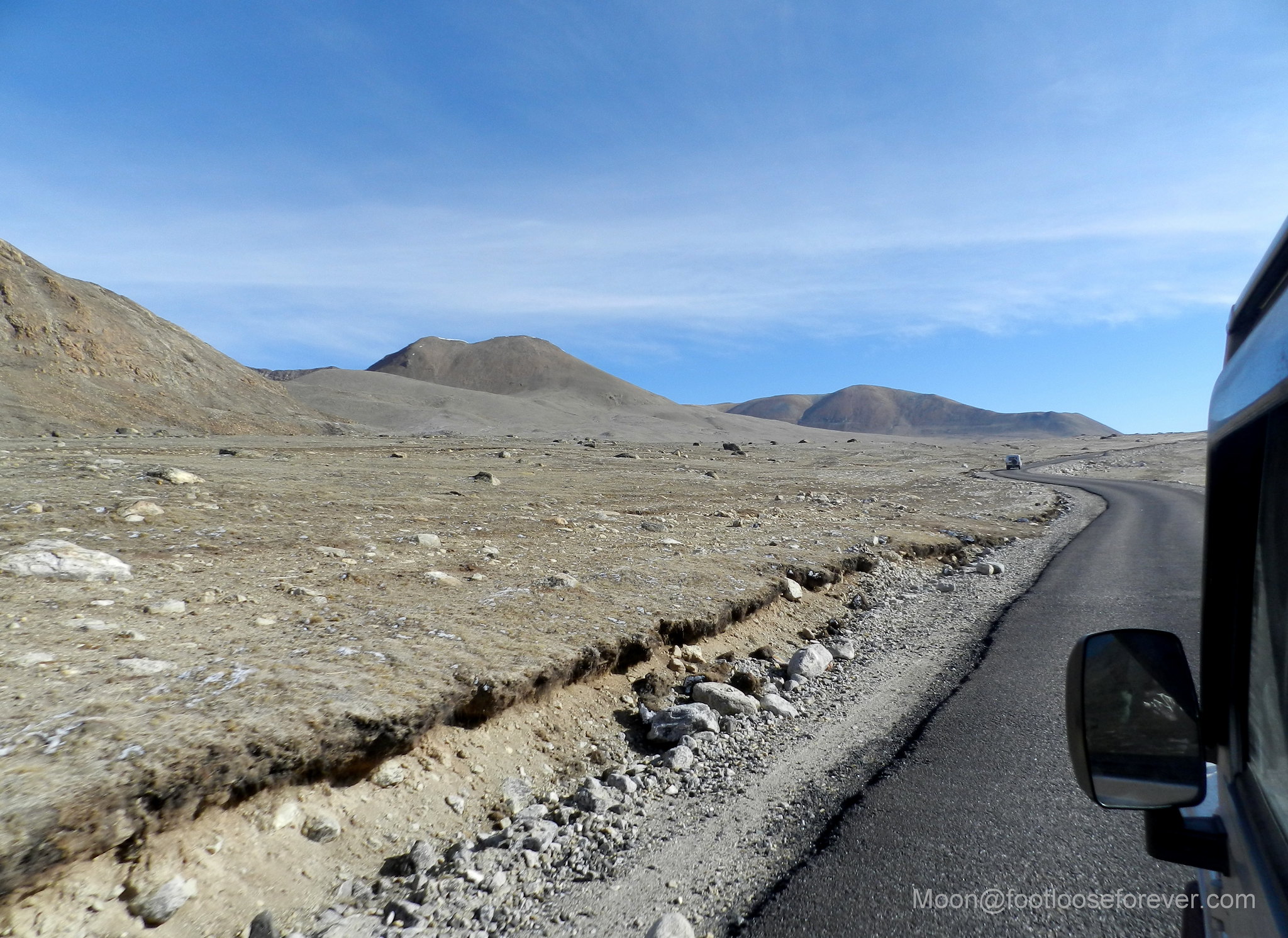
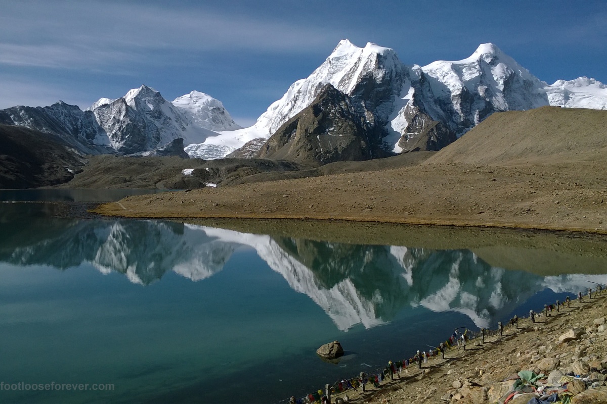
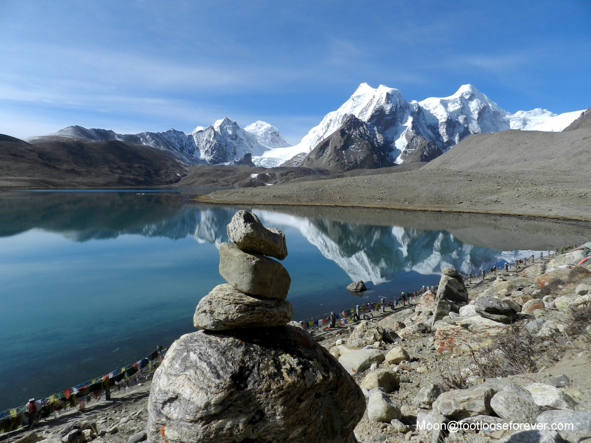
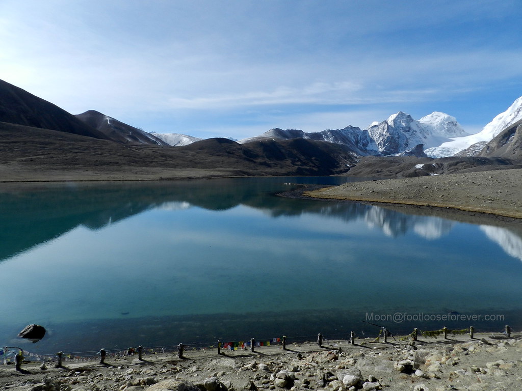
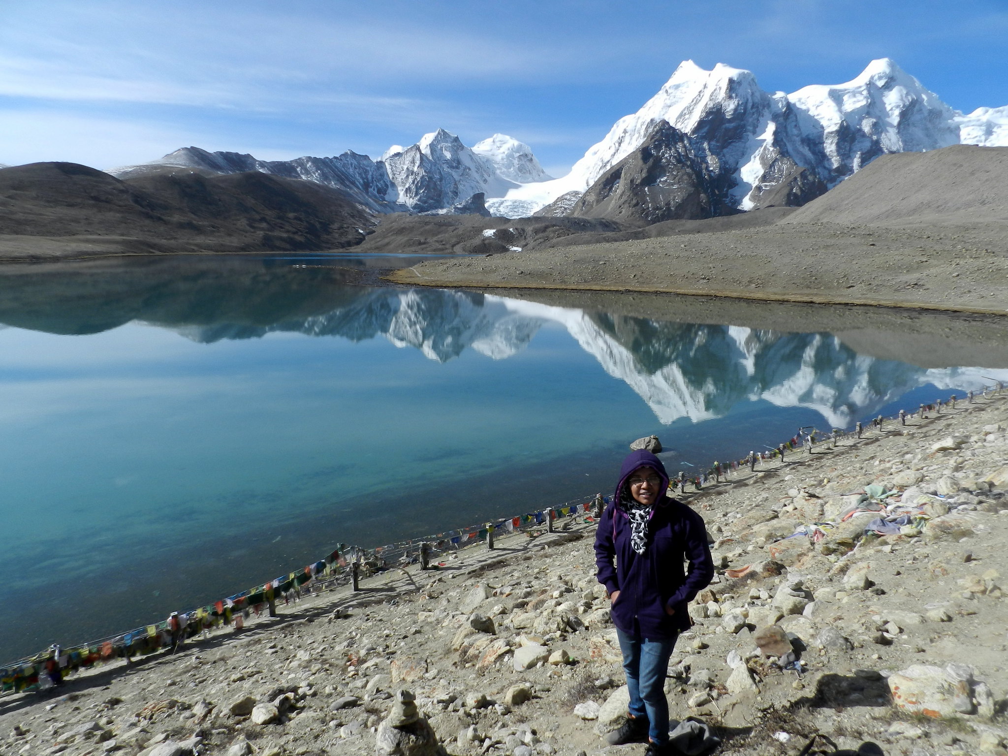
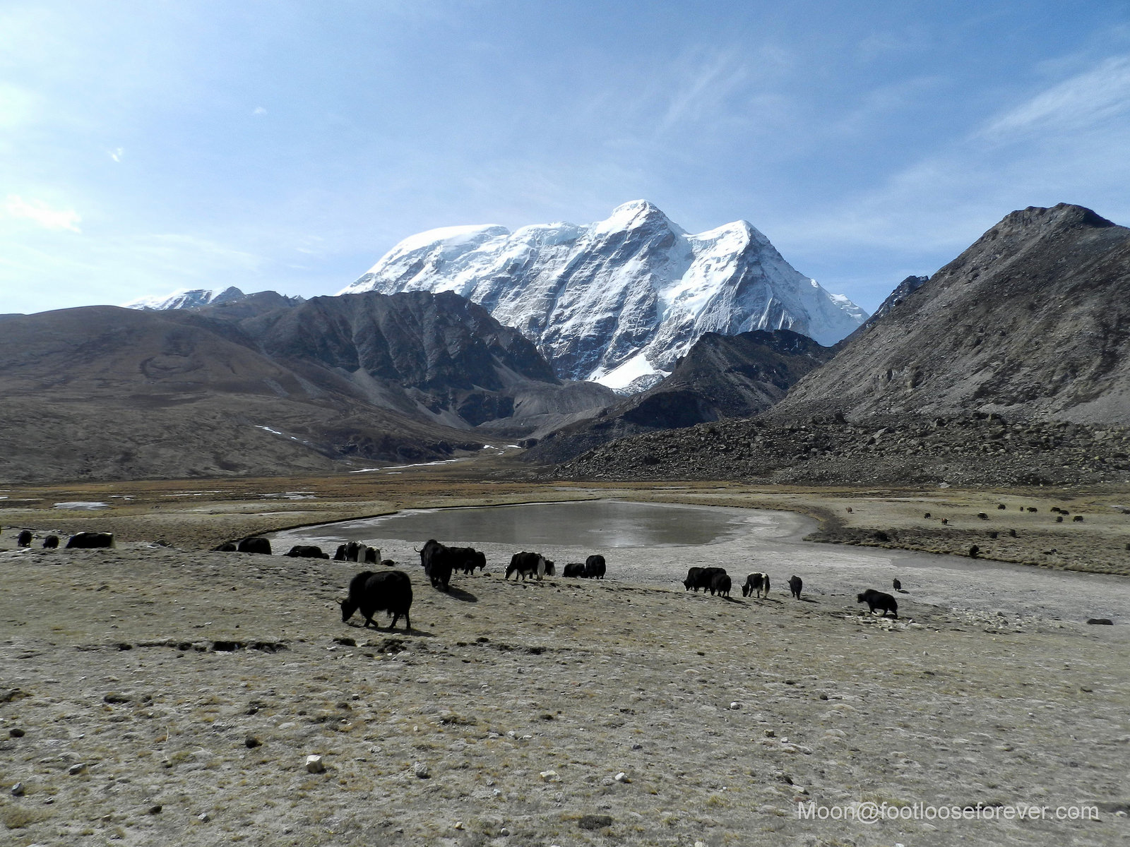
Finally, we reached our destination, Lake Gurudongmar, at 7:30 am. That’s how the holy lake looked like in the morning light – still, calm, and unspoiled.

lake gurudongmar, north sikkim, reflection

The first few moments were speechless in silent admiration to such divine beauty.

gurudongmar, lake, north sikkim

There is a temple on the bank. I didn’t find time to enter as I was too busy in absorbing the beauty of nature all around.

gurudongmar, holy lake, north sikkim, himalayas

prayer flags, colors, north sikkim, gurudongmar

lake gurudongmar, north sikkim

Gurudongmar, north sikkim, landscape

And of course, posing for the camera with the lake on the backdrop. 😉

gurudongmar, holy lake, north sikkim, nature

However, amid this clean and clear environment, the taxis/rental cars were the direct agent of air pollution. These rental cars are so poorly maintained in Sikkim. I wonder why the local administration is so indifferent about them while it is so strict about keeping Gangtok clean.

environmental pollution, north sikkim, gurudongmar, mountains

In addition, there are the “litterbugs” who never forget to throw off their disposable belongings anytime, anywhere. If you zoom into the picture (below) you’ll see the discarded water bottles. Is it not the responsibility of the visitors, too, to keep the environment clean?

mountains, gurudongmar, environmental pollution, north sikkim

Our Tour Plan

We were lucky to have the weather in our favor during our tour from May 7 to 12, 2016. Our North Sikkim tour included 2-night 3-day Lachung-Lachen package. We stayed at Hotel Meylong in Gangtok and booked the Lachung-Lachen tour package through our hotel. You can check out my review of Hotel Meylong on TripAdvisor for more information.

Our North Sikkim tour plan was like this –

Day 1: NJP (New Jalpaiguri) to Gangtok (We reached NJP from Kolkata at around 9am by Padatik Express)

Day 2: Gangtok to Lachung (Night stay at Lachung)

Day 3: Visit Yumthung Valley and Zero Point – Back to hotel at Lachung for lunch – drive to Lachen (Night stay at Lachen)

Day 4: Visit Lake Gurudongmar and drive back to hotel for lunch – return to Gangtok by evening

Day 5: Gangtok sightseeing

Day 6: Visit Changu (Tsomgo Lake), Baba Mandir and Nathu La pass and return to Gangtok

Day 7: Start for NJP after lunch and reach there by 7:30 pm and board the train to Kolkata

Some Important Info

Please note that if you are an Indian citizen, you should carry your Voter ID card/PAN card/driving license as photo identity proof along with 4-5 photocopies of the same document and an equal number of passport size photographs for Lachung-Lachen tour. You may need to submit these documents to get the travel permit. However, you cannot rent cars on your own and arrange the tour directly. You have to go via a local tour operator or your hotel’s travel desk. They will arrange everything for you.

Finally, don’t forget to pack an umbrella if you are visiting in the May-June season. You may need it anytime. 🙂

To be continued…

discover-badge-circle

Bhutan Tour: My Rendezvous with Paro

paro, bhutan, paro valley

If I start talking (read ‘writing’) about Paro I won’t be able to include everything in one post. Paro is so beautiful and that beauty has so many facets to it that it is impossible for me to sum it up here. So it’s better to share the picturesque beauty in picture instead of words. 🙂  

Finally the day came. We had to leave Thimphu for Paro. Our journey to Paro started at 10:30 am (IST) and we reached there at 12:30 pm (IST).

paro, bhutan, valley

Paro, a fertile valley on the banks of the river Paro, surrounded by the sublime Himalayan Mountains, beckons travelers with its greenery, scenic beauty, and ample scope to explore the rich cultural heritage of Bhutan.

Paro monastery, paro, bhutan

I had heard a lot about this spectacular valley, which is dotted with monasteries, sacred edifices and landmarks,

Buddhist monastery, paro, bhutan

and a small but lively township, which we were to explore next.

Paro town, paro, bhutan

The river Paro meanders through the vale dividing it in two halves.

paro chhu. paro river, paro, bhutan, valley
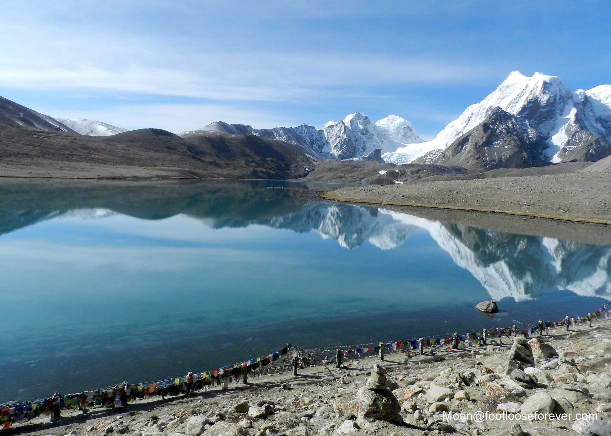
Although there were occasional rain clouds hovering over the valley, the weather in Paro was warmer during the day than that was in Thimphu. But the nights were pleasant in summer months (May-June).

paro valley, bhutan

Initially, it was mountains on both sides of the road.

Paro, Bhutan, mountain road

As we entered Paro District the roads turned wider. The glimpses of the river running in parallel with the road made the journey even more exciting and visually appealing.

Paro, Bhutan, valley

paro, bhutan

paro, bhutan, valley, mountains

paro valley, bhutan

Finally we reached the point where we could meet Paro, the river. This is the place where you can touch, feel, and walk into the cool waters and enjoy a cable car ride across the river. 🙂

paro, bhutan, paro river

paro chhu, paro river, paro, bhutan

paro chhu, paro river, paro, bhutan

in paro, bhutan, paro chhu

After an exciting rendezvous with Paro Chhu (‘chhu’ is river in vernacular) we were back on the road again, heading towards our hotel. We drove past the small cottages,

paro valley, bhutan

lush green paddy fields,

paro valley, bhutan, paddy fields in Paro

and the small but spectacular Paro Airport.

paro airport, paro, bhutan

paro, paro airport, bhutan

It seemed Paro greeted us with waving white flags on the roadside

paro, bhutan, flags, Buddhist culture

and the rustling branches of peaches blooming with white flowers, everywhere. 🙂

peach flower, paro, bhutan, white flowers,

Our car finally stopped at the gate of the hotel Mandala Resort Garden, a hotel with excellent views, I must say.

orchid, paro, bhutan, mandala resort garden hotel

mandala resort garden, paro hotels, hotel in paro

paro hotels, hotel in paro, mandala resort garden

Whichever side your room is, you are entitled to get a clear view of the valley from the room as long as you are in Mandala Resort Garden. However, it is located in the hills outside the town of Paro, within 10 minutes’ drive from Paro Market.

paro, bhutan, paro hotels, hotel in paro, mandala resort garden

mandala resort garden, paro hotels, hotel in paro, bhutan

I’ll soon share the story of my sightseeing in Paro. But before that, enjoy some more colorful panorama of this beautiful valley through my lens. 🙂

paro, bhutan, paro hotels

paro, valley, rice terraces, paddy field, greenery, bhutan

pines, paro, bhutan

paro, paro valley, bhutan

paro hotels, mandala resort garden, hotels in paro, bhutan

paro, bhutan, bhutanese women

paro, valley, paro chhu, bhutan

paro chhu, paro, bhutan

paro chhu, paro, river, bhutan

Hope you enjoyed Paro tour with me. 🙂   Stay tuned for more.

in Paro, Bhutan

P.S: This is Part V of my Bhutan Tour Photo Essay Series. You can also check out the first four posts of this series for more photos and information on Bhutan travel.

Image

“My ultimate search has been for a muse”

road to Paro, hills, mountains, entering Paro, Bhutan

My ultimate search has been for a muse.

Dominic Monaghan

And I have found her in the mighty mountains, in the verdant vales and in the green slopes of the hills. I would love to come back a thousand times to the road that leads to mountain.

I can remember it was a cloudy day and it drizzled quite a few times during was our journey from Thimphu to Paro. I don’t understand the connection between rain and my travelling to hill stations… 🙂  But I must agree that the hill stations in the Himalayas have a different beauty when it rains.

road to Paro, hills, mountains, entering Paro, Bhutan

Published in response to the Daily Post Weekly Photo Challenge: Muse.